
مواقع التدريسيينجامعة الكوفة
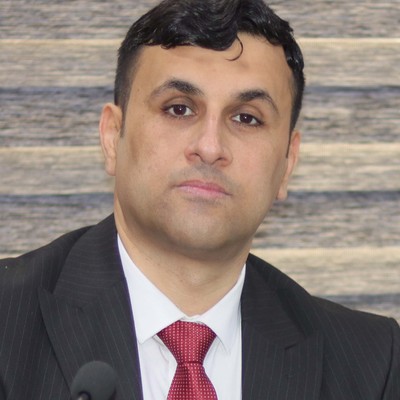
علي صالح مهدي اليعقوبي
مدرس مساعد

علي صالح مهدي اليعقوبي

English Version
0بحث منشور
0محاضرة
0خبر

الملف الشخصي

موظف في جامعة الكوفة منذ 2008
موظف في كلية العلوم منذ 2012
بكالوريوس علوم فيزياء كلية العلوم جامعة الكوفة 2007
ماجستير علوم فيزياء كلية العلوم جامعة الكوفة 2024

البحوث المنشورة

2

Changes Detection Using Multispectral Satellite Images for Sustainable Development in some Regions of Al-Najaf Al-Ashraf, Iraq.

الباحثونAli Salih Mahdi، Ahmed Asal Kzar
المجلةكلية العلوم - جامعة الكوفة
مختصر البحث

change detection in urban and surrounding areas, such as vegetation and bare, is a significant achievement for sustainable development, especially nowadays. The research used a supervised classification technique of two images representing two time periods (1973 and 2023) by applying the technique of land cover and land use (LCLU) using the ArcGIS 10.8.2 program. The classified pixels were converted into digital data to compare the using of the land cover method and land use change (LCLUG). The results showed a significant expansion in the urban areas of Najaf and Kufa districts, from 5.72 km2 to 134.95 km2, with a decrease in the area of green areas, from 17.26 km2 to 15.16 km2, and the absence of water areas, in addition to the transformation of most of the barren areas to urban areas (215.64 km2 to 88.51 km2). The study concluded that there was a significant decrease in green areas and the absence of water bodies in urban areas, and these are two indicators - along with the increase in urban areas can harm the environment of the region and the quality of environmental influences on the lives of the people who live in it. Finally, this, in turn, would negatively affect its sustainable development plans.

Euphrates River Prediction Using Remote Sensing Techniques for Sustainable Development in Al-Najaf Al-Ashraf, Iraq

الباحثونAli Salih Mahdi، Ahmed Asal Kzar
المجلةMaterials Science Forum
مختصر البحث

The study dealt with an essential aspect of sustainable development: water. Because of the great importance of knowing the change in water quantities during specific periods, the study resorted to using remote sensing techniques and analyzing multispectral images from the Landsat satellite for 1985, 1993, 2003, 2014 and 2023, and revealing the percentage of change in the water body of the Euphrates River passing through the eastern region of the city of Kufa in the middle of the Najaf Governorate, using the land use and land cover method (LULC) and this was done after classifying the images used using the maximum likelihood classification method, the image was divided into four classes: urban lands, agricultural lands, barren lands, and the water body. Based on the graphical analysis of the changes that occurred in these four classes and using the Curve Fitting method, a regression equation was created, which was used to predict the quantities of the water body available and the land cover surrounding it, for the next ten years up to the year 2033 and based on the extracted results, the study concluded a significant decrease in the water body of the Euphrates River and the agricultural lands surrounding it, with a noticeable increase in urban and barren areas, The study recommended paying attention to sustainable sources of water, such as rainwater and others, and correctly investing them, taking into account the social and economic reasons that directly affected the quantities of river water.

المحاضرات

2

Band Combinatios Multispectral Imagery

تحسس نائي

Digital Number, Radiance, and Reflectance

تحسس نائي

الأخبار والإعلانات

3
الأخبار 2024-04-11

حلقة نقاش عن استخدام صور الاقمار الصناعية لأغراض التنمية المستدامة

حلقة نقاش عن استخدام صور الاقمار الصناعية لأغراض التنمية المستدامة عقد قسم الفيزياء حلقة نقاش بعنوان استخدام صور الاقمار الصناعية متعددة الاطياف لأغراض التنمية المستدامة في محافظة النجف الاشرف. وتضمنت الحلقة محاضرة للباحث علي صالح مهدي تناولت استخدام تقنيات قسم وخلصت الحلقة الى اهمية البيانات التي تقدمها تقنيات الاستشعار عن بعد الى اصحاب القرار في محافظة النجف الاشرف لغرض استخدامها في التنمية المستدامة.

الأخبار 2024-04-11

قسم الفيزياء يعقد حلقة نقاش عن استخدام تقنيات الاستشعار عن بعد للتنبؤ بكمية مياه نهر الفرات

قسم الفيزياء يعقد حلقة نقاش عن استخدام تقنيات الاستشعار عن بعد للتنبؤ بكمية مياه نهر الفرات عقد قسم الفيزياء حلقة نقاش بعنوان التنبؤ بكميات المياه في نهر الفرات باستخدام تقنيات الاستشعار عن بعد لأغراض التنمية المستدامة في محافظة النجف الاشرف . وتضمنت الحلقة محاضرة للباحث علي صالح مهدي تناول فيها دراسة الجزء المار في محافظة النجف من نهر الفرات باستخدام تقنيات الاستشعار عن بعد من خلال تصنيف صور الاقمار الصناعية المعتمدة الى اربع فئات رئيسة هي المسطحات المائية والمناطق الزراعية والمناطق الحضرية والمناطق الجرداء . وتطرقت الحلقة الى استخدام عمليات حسابية معينة وانشاء معادلة رياضية للتنبؤ بكمية المياه في نهر الفرات عند حلول العام 2033

الأخبار 2024-04-11

رسالة ماجستير عن تحقيق التنمية المستدامة باستخدام صور الاقمار الصناعية

رسالة ماجستير عن تحقيق التنمية المستدامة باستخدام صور الاقمار الصناعية بحضور رئيس الجامعة ومعاونه الاداري وعميد كلية العلوم ناقش قسم الفيزياء رسالة ماجستير للباحث علي صالح مهدي بإشراف الدكتور أحمد عسل كزار بعنوان استخدام صور الاقمار الصناعية متعددة الاطياف للفترة من 1973 الى 2023 لاغراض التنمية المستدامة في محافظة النجف الاشرف العراق. وهدفت الرسالة الى تحقيق بعض اهداف التنمية المستدامة من خلال استخدام صور الاقمار الصناعية (لاندسات) لسنوات مختارة محصورة بين 1973و 2023 في مناطق محددة بمحافظة النجف وتصنيف الصور المستخدمة وايجاد الفرق بين المساحات المصنفة وايجاد معادلات تمثل العلاقة بين المساحات والفترات الزمنية للتنبؤ بالمساحات في السنوات القادمة. وتوصلت الدراسة الى ايجاد معلومات عن التغير بالمساحات( المائية، الخضراء، الحضرية، المناطق الفارغة) للسنوات المحددة السابقة والحالية والمستقبلية وانجاز تقرير مفصل عنها مما يمكن اصحاب القرار من الاستفادة من المعلومات والبيانات الوارد فيه لتحقيق التنمية المستدامة في محافظة النجف الاشرف

عرض التفاصيل